
TORNADOES.
HURRICANES.
HEAT WAVES.
Learn about nature’s most fearsome threats—and the power of seeing them coming


Praise for Cloud Warriors
“A fascinating, vivid, and
enlightening book.
Cloud Warriors sets a standard in storytelling about our era's most advanced technology, and highest-stake global (and local) trends, in clear and gripping terms. I will never look at the skies, or a weather forecast, in the same way again.”
—James Fallows, author of Our Towns: A 100,000 Mile Journey into the Heart of America
in the news
-
![]()
The Future of Weather Forecasting Is Hyperlocal: Cloud Warriors Excerpt
-
![CNBC]()
Tom Weber on CNBC's Squawk Box Talking Business and Hyperlocal Forecasting
-
![]()
‘Perfect’ Gift: Why Cloud Warriors Should Be On Your Holiday List
-
![]()
The Best Science and Technology Books of 2025
-
![New York Times Climate Forward]()
Cloud Warriors Makes the Case for Meteorologists
-
![]()
Texas Floods: Tom Weber On Why Protecting Local Forecast Offices Is Critical
-
![]()
Cloud Warriors Named Inaugural Pick for Summer Book Club: Interview With Tom Weber
-
![]()
Tom Weber ’89 And The Quest to Understand Extreme Weather
-
![]()
Local Efforts Are Essential For Tackling Growing Health Threat from Extreme Heat
-
![]()
Hurricane Season: Q&A With Tom Weber on Cuts to Vital Research
-
![]()
Author Tom Weber on Weather Threats and How Forecasts Empower Communities
-
![]()
Why Better Forecasts Matter: Tom Weber Joins the Podcast
-
![]()
Tom Weber Joins the WeatherBrains: The Value of the Forecast
-
![Connecticut Public]()
Cloud Warriors on All Things Considered
-
![]()
Editor’s Picks for June
-
![]()
Cloud Warriors: On the Frontier of Forecasting
-
![]()
Publishers Weekly: Cloud Warriors Is an ‘Eye-Opening’ Nonfiction Debut
-
![]()
Writer Decodes the Frontier of Weather Forecasting
-
![]()
McKinsey Author Talk: Tom Weber on How Business Leaders Can Put Better Forecasts to Work


Photograph by Emil Cohen
About the Author
THOMAS E. WEBER
is a veteran writer, editor, and newsroom executive with a lifelong interest in how science and technology shape society. He was The Wall Street Journal’s first internet columnist and later became a bureau chief for the paper. As executive editor of Time, he supervised the magazine’s feature journalism. Tom has taught journalism and publishing at Columbia University and New York University as well as at his alma mater, Princeton University. He lives in New York City with his wife.
ORDER TODAY
ORDER TODAY
Bookstores
Audiobook
Praise for CLOUD WARRIORS
The Gallery
BEHIND THE SCENES

While out pursuing tornadoes, NSSL storm-chasers stop occasionally to launch weather balloons that take readings as they ascend thousands of feet. These balloons, which are also routinely launched at forecast offices, provide valuable insights on conditions.
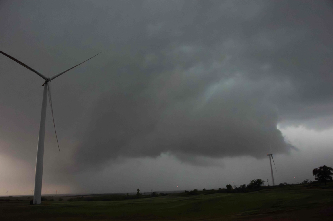
A supercell displaying what’s known as a wall cloud, as photographed by me during a storm chase in southwest Oklahoma. Because they can presage a tornado, these formations are of key interest to researchers.

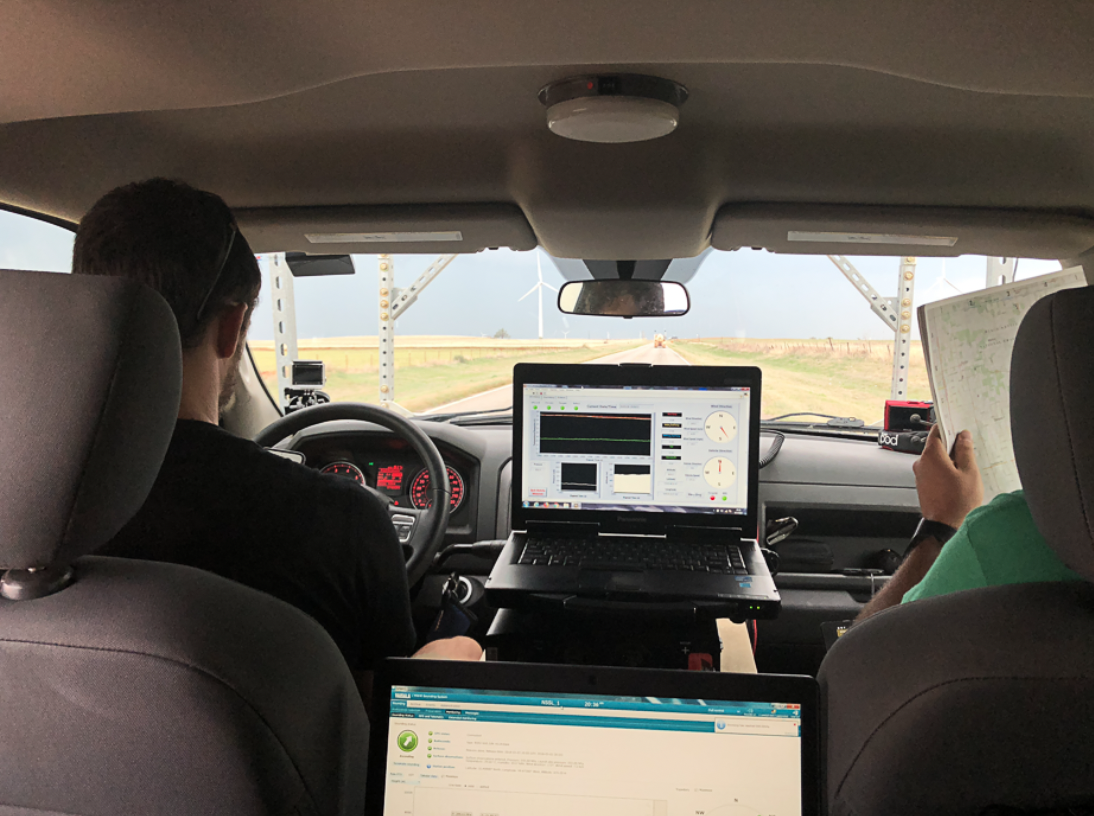
Storm-chasers at the National Severe Storms Laboratory gather data with these instrument-studded trucks to better understand tornadoes. To protect the truck from pummeling by hailstones, a wire screen extends over the windshield and hood.

At the National Weather Center in Norman, Oklahoma, government researchers and forecasters work alongside university experts to improve tornado warnings and advance the quality of predictions.
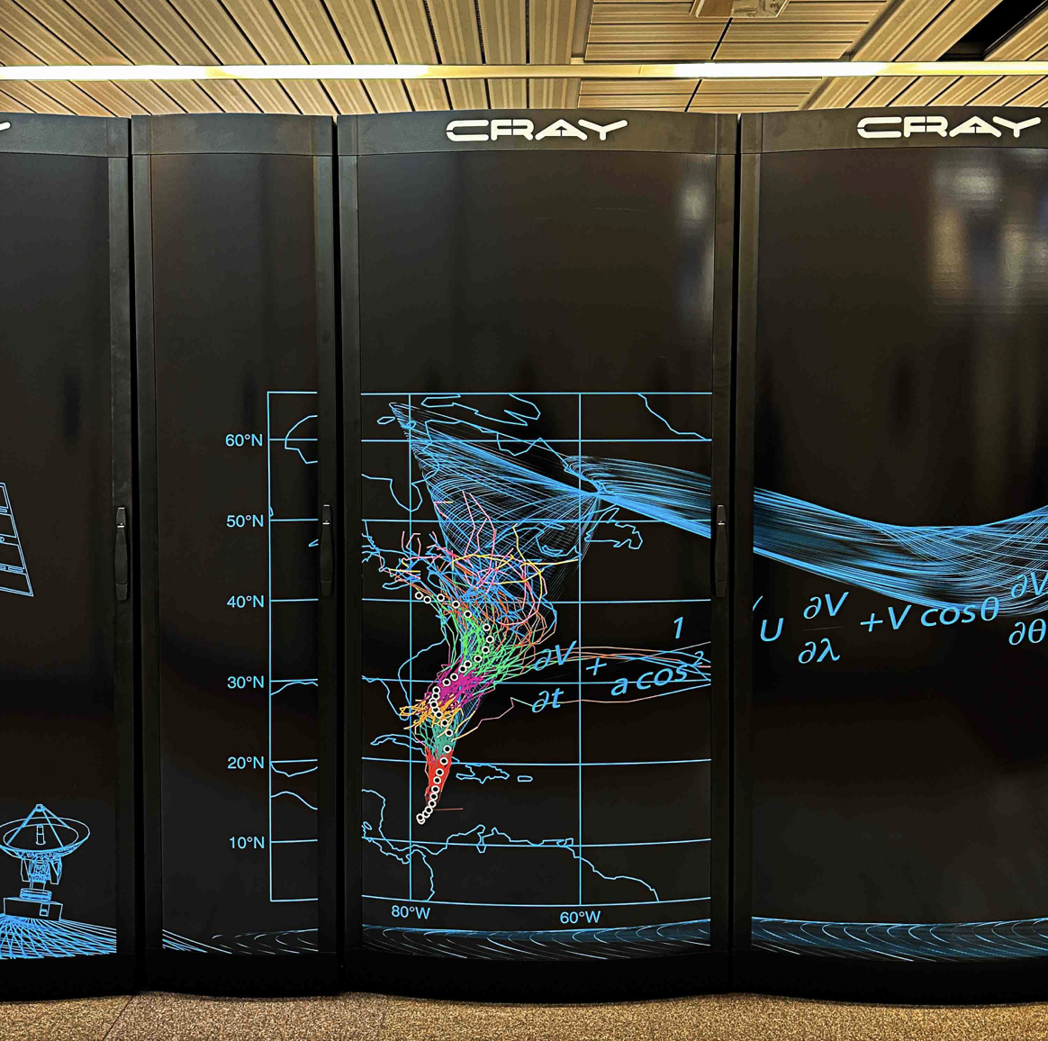
A supercomputer at the ECMWF. The artwork shows the US East Coast, commemorating the group’s forecast of Hurricane Sandy in 2012. That forecast was celebrated for its accuracy after Sandy slammed into the New Jersey coast.

To learn about computer systems that power predictions, I traveled to Reading, England, to the European Centre for Medium-Range Weather Forecasts, home of the top global model. In a quirky tradition, visitors often bring rubber ducks to add to this display.

To discover urban heat islands, volunteers drive probe-equipped vehicles on routes like these superimposed on a map of Richmond, Virginia. I rode along to see the data being captured in real time.

Volunteers drive cars with these probes to gather temperature and air-quality readings. Riding along in this SUV I was able to observe the hot spots of Richmond, Virginia, and also see factors that contribute to the problem, such as lack of tree cover.

Heat-mapping projects gather minute-by-minute temperature readings to discover which neighborhoods are most vulnerable. Among weather dangers, heat is the deadliest in the US.
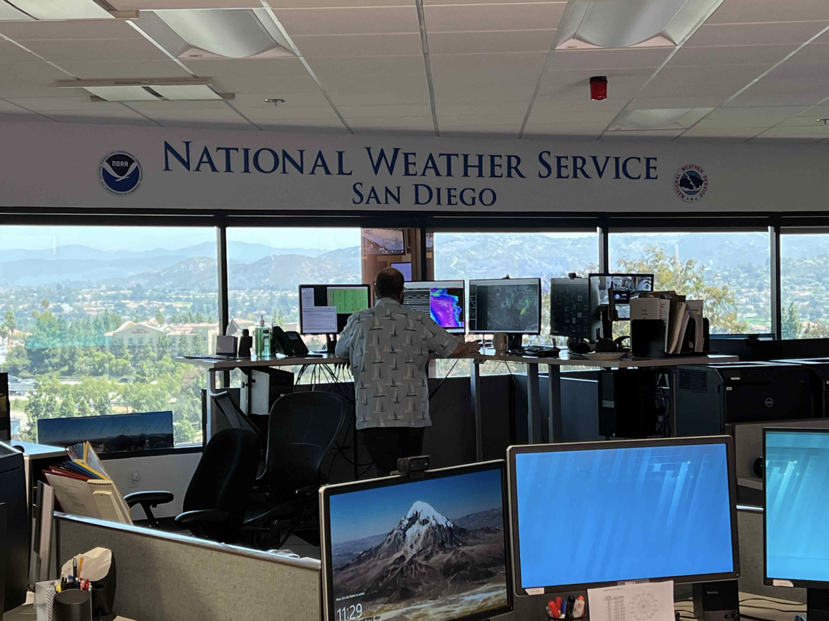
I traveled to San Diego to observe public/private cooperation critical to wildfire prevention. Weather Service forecasters here coordinate constantly with key groups, including Cal Fire and the San Diego power utility.
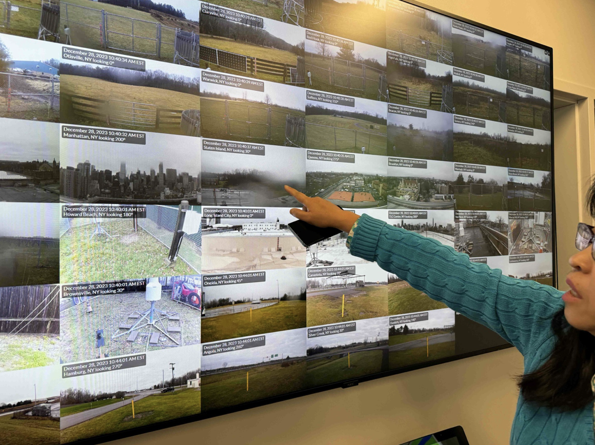
The New York State Mesonet blankets the area with weather stations that provide granular data that helps everyone from the Department of Transportation to local emergency managers. Cameras with the instruments give real-time views of conditions.
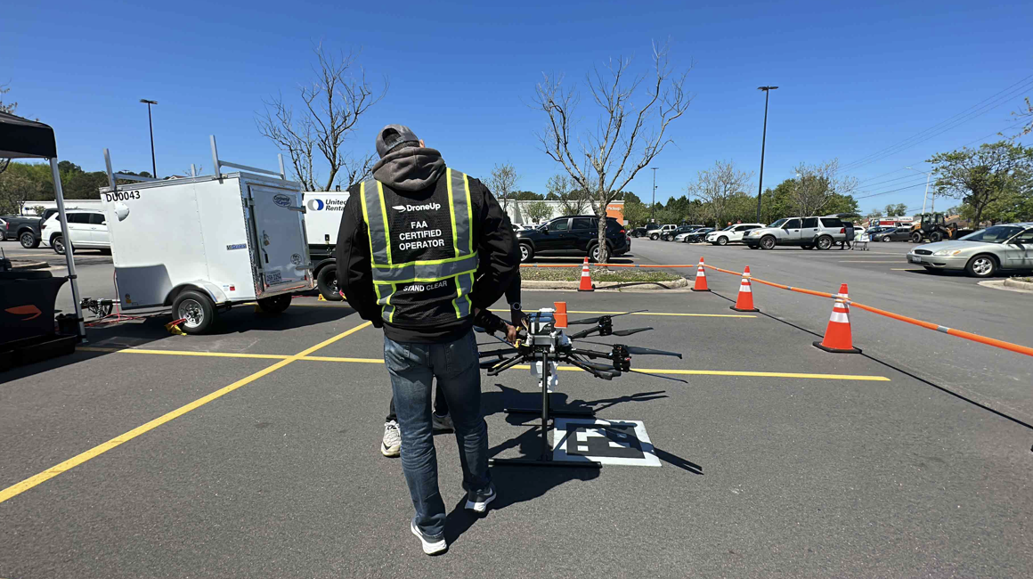
Better forecasts are good for business and new industries, as I saw at this Walmart. To get drone deliveries safely to their destinations, operators review critical hyperlocal forecasts of nearby wind conditions.
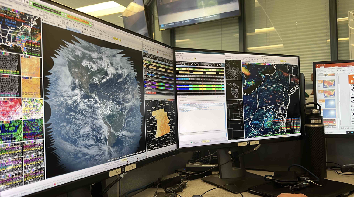
The dizzying array of windows on a typical National Weather Service forecaster’s workstation. Meteorologists sift constantly through hundreds of data sources to fine-tune predictions, as I saw when I embedded with a local-office meteorologist.